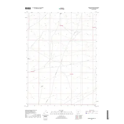
2017 Map of Sooner Reservoir
USGS Topo · Published 2017About this map
Sooner Reservoir lies at the heart of this high-desert landscape in Sweetwater County, serving as a vital water source in an arid region defined by seasonal drainages. The map reveals a network of remote corridors including Riner Cutoff Rd and Co Rd 63, which trace the paths once established for ranching and resource access. Geologic features such as Stratton Draw and Battle Spring Draw carve through the terrain, illustrating the natural drainage patterns that have shaped the land's utility for generations. This survey by the U.S. Geological Survey provides a detailed look at the cadastral grid, showing the township and range lines of T25N R92W and T24N R92W, essential for researchers tracking land ownership and mineral rights in the Wyoming interior.
Find a feature on this map
10 named features on this map. Tap any name to fly to it.
Don’t see what you’re looking for? This feature index may not catch every label — zoom into the map to look around manually.
Map Details
Editions of this 2017 Sooner Reservoir Map
This is the sole edition of this map. No revisions or reprints were ever made.
Other maps of this area

1954 · Rawlins
USGS Topo · 1:250,000

1955 · Casper
USGS Topo · 1:250,000

1958 · Rawlins
USGS Topo · 1:250,000

1958 · Casper
USGS Topo · 1:250,000

1960 · Battle Spring
USGS Topo · 1:24,000

1960 · Hansen Lake NE
USGS Topo · 1:24,000

1960 · Sooner Reservoir
USGS Topo · 1:24,000

1960 · Larsen Knoll
USGS Topo · 1:24,000

1960 · Hansen Lake
USGS Topo · 1:24,000

1960 · Chicken Spring
USGS Topo · 1:24,000