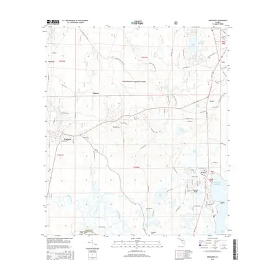
2015 Map of Sopchoppy
USGS Topo · Published 2015About this map
The Sopchoppy River snakes southward through the wetlands of the Apalachicola National Forest, defining the transition from the pine flatwoods to the coastal estuaries of the Gulf of Mexico. This 2015 survey reveals a landscape where freshwater systems like Buckhorn Cr and the Dead River meet tidal influences at Levy Bay. The town of Sopchoppy sits as a central hub, while the coastal community of Panacea anchors the southeastern corner, connected by a network of local roads such as Surf Rd and Dickson Bay Rd.
Find a feature on this map
87 named features on this map. Tap any name to fly to it.
Don’t see what you’re looking for? This feature index may not catch every label — zoom into the map to look around manually.
Map Details
Editions of this 2015 Sopchoppy Map
This is the sole edition of this map. No revisions or reprints were ever made.
Other maps of this area

1940 · Arran
USGS Topo · 1:62,500

1943 · Arran
USGS Topo · 1:62,500

1943 · St. Teresa Beach
USGS Topo · 1:24,000

1943 · Lighthouse Point
USGS Topo · 1:24,000

1945 · Bradwell Bay
USGS Topo · 1:31,680

1945 · Lighthouse Point
USGS Topo · 1:31,680

1945 · Mc Intyre
USGS Topo · 1:31,680

1945 · St Teresa
USGS Topo · 1:31,680

1945 · Sanborn
USGS Topo · 1:31,680

1949 · Apalachicola
USGS Topo · 1:250,000