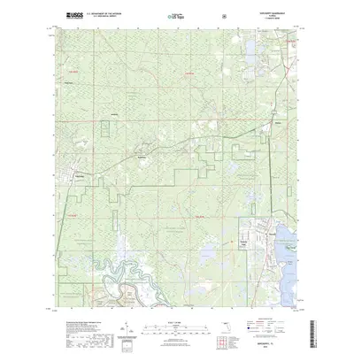
2024 Map of Sopchoppy
USGS Topo · Published 2024About this map
The Sopchoppy River defines the western reaches of this landscape, winding toward the Gulf of Mexico through the heart of the Apalachicola National Forest. This modern survey details the transition from the pine flatwoods and cypress strands of the forest to the tidal marshes of the Saint Marks National Wildlife Refuge and Saint Marks Wilderness. The town of Sopchoppy serves as a central hub, while the coastal settlement of Panacea sits at the edge of Dickerson Bay, reflecting a community deeply tied to the surrounding waterways and maritime heritage. For those tracing local lineage, several family and community burial grounds are mapped, including Grimes Cem, Simmons Cem, and the Mount Trial Memorial Cem. The network of forest roads and trails, such as the Florida National Scenic Trl, highlights the area's significance for conservation and recreation between Oak Park Rd and the shores of Apalachee Bay.
Find a feature on this map
113 named features on this map. Tap any name to fly to it.
Don’t see what you’re looking for? This feature index may not catch every label — zoom into the map to look around manually.
Map Details
Editions of this 2024 Sopchoppy Map
This is the sole edition of this map. No revisions or reprints were ever made.
Other maps of this area

1940 · Arran
USGS Topo · 1:62,500

1943 · Arran
USGS Topo · 1:62,500

1943 · St. Teresa Beach
USGS Topo · 1:24,000

1943 · Lighthouse Point
USGS Topo · 1:24,000

1945 · Bradwell Bay
USGS Topo · 1:31,680

1945 · Lighthouse Point
USGS Topo · 1:31,680

1945 · Mc Intyre
USGS Topo · 1:31,680

1945 · St Teresa
USGS Topo · 1:31,680

1945 · Sanborn
USGS Topo · 1:31,680

1949 · Apalachicola
USGS Topo · 1:250,000