2025 Map of Sopchoppy
USGS Topo · Published 2025About this map
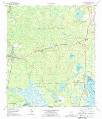
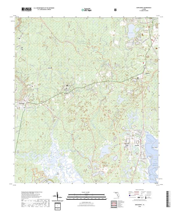
The Apalachicola National Forest dominates the upper half of this coastal landscape, where the Sopchoppy River meanders toward the marshlands of the Gulf of America. This modern-era survey shows the transition from dense forest to the tidal creeks of Dickerson Bay, punctuated by established communities like Sopchoppy and Panacea. Genealogists will find a cluster of cemeteries in the rural interior, including Simmons Cem and Buckhorn Cem, documenting the area's local history. To the south, the Ochlockonee River State Park marks the confluence of the Ochlockonee River and Dead River, preserving the character of the Florida Panhandle before the waters reach Apalachee Bay. The map also captures several family-named landmarks and local roads such as Lawhon Mill Rd and Friendship Church Rd, providing a clear view of the region's current residential and natural boundaries.
Find a feature on this map
96 named features on this map. Tap any name to fly to it.
Don’t see what you’re looking for? This feature index may not catch every label — zoom into the map to look around manually.
Map Details
Editions of this 2025 Sopchoppy Map
This is the sole edition of this map. No revisions or reprints were ever made.