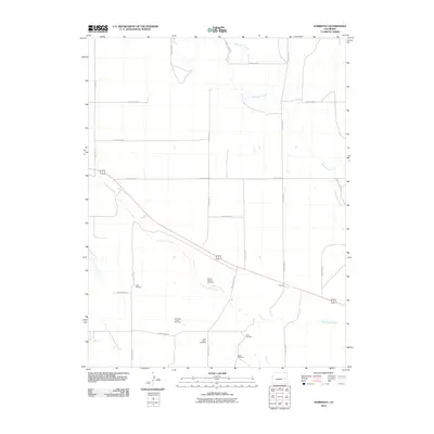
2010 Map of Sorrento
USGS Topo · Published 2010About this map
Sorrento sits at a geographic crossroads in Cheyenne County, where the high plains landscape is defined by the ephemeral flows of Big Sandy Creek and Wild Horse Creek. This 2010 survey reveals a regional reliance on groundwater management, documented through a significant network of named windmills such as the School Section Windmill and the Drift Fence Windmill. The map's grid of section lines and county roads, including County Road R and County Rd 12, illustrates the structured agricultural layout of the area. Local history researchers will find interest in specifically named sites like the Branding Corral Windmill and Town Windmill, which point to the ranching heritage and community infrastructure necessary for life in this part of eastern Colorado. The presence of these named landmarks provides clear points of reference for tracing property boundaries and historical land use across the prairie.
Find a feature on this map
25 named features on this map. Tap any name to fly to it.
Don’t see what you’re looking for? This feature index may not catch every label — zoom into the map to look around manually.
Map Details
Editions of this 2010 Sorrento Map
This is the sole edition of this map. No revisions or reprints were ever made.
Other maps of this area

1891 · Arroyo
USGS Topo · 1:125,000

1891 · Kit Carson
USGS Topo · 1:125,000

1893 · Arroyo
USGS Topo · 1:125,000

1893 · Kit Carson
USGS Topo · 1:125,000

1954 · Lamar
USGS Topo · 1:250,000

1958 · Lamar
USGS Topo · 1:250,000

1978 · Galatea NE
USGS Topo · 1:24,000

1978 · Sanders Ranch
USGS Topo · 1:24,000
1978 · Wild Horse
USGS Topo · 1:24,000

1981 · Cheyenne Wells
USGS Topo · 1:100,000