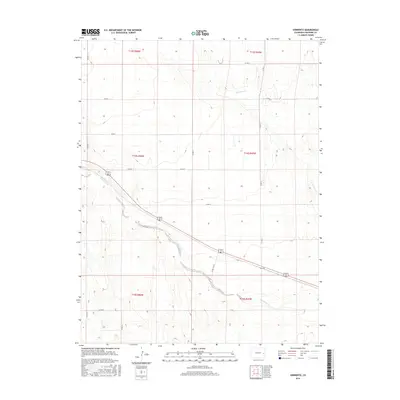
2016 Map of Sorrento
USGS Topo · Published 2016About this map
Sorrento sits in the high plains of eastern Colorado, marking a small settlement node along the transit corridor between larger regional hubs. The landscape here is defined by the braided path of Big Sandy Cr, which cuts a wide, low-lying drainage across the southwestern portion of the sheet. This seasonal waterway, alongside Wild Horse Cr in the northeast, dictates the local topography and the placement of the sparse road network.
Find a feature on this map
20 named features on this map. Tap any name to fly to it.
Don’t see what you’re looking for? This feature index may not catch every label — zoom into the map to look around manually.
Map Details
Editions of this 2016 Sorrento Map
This is the sole edition of this map. No revisions or reprints were ever made.
Other maps of this area

1891 · Arroyo
USGS Topo · 1:125,000

1891 · Kit Carson
USGS Topo · 1:125,000

1893 · Arroyo
USGS Topo · 1:125,000

1893 · Kit Carson
USGS Topo · 1:125,000

1954 · Lamar
USGS Topo · 1:250,000

1958 · Lamar
USGS Topo · 1:250,000

1978 · Galatea NE
USGS Topo · 1:24,000

1978 · Sanders Ranch
USGS Topo · 1:24,000
1978 · Wild Horse
USGS Topo · 1:24,000

1981 · Cheyenne Wells
USGS Topo · 1:100,000