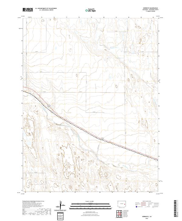
2022 Map of Sorrento
USGS Topo · Published 2022About this map
Big Sandy Creek and Wild Horse Creek define the drainage patterns across this section of Cheyenne County, where the High Plains landscape is marked by a strict orthogonal grid of rural thoroughfares. This 2022 survey captures the modern alignment of the county road system, including unique alphanumeric designations like Co Rd 12 8/10 and Co Rd T, which facilitate access across the vast agricultural and rangeland tracts. The terrain is characterized by subtle elevation changes and intermittent watercourses, reflecting the environmental realities of eastern Colorado's arid climate. The map serves as a contemporary record of land divisions, from the primary channel of Big Sandy Creek in the south to the headwaters of Wild Horse Creek in the north, detailing the essential infrastructure of this sparsely populated ranching region.
Find a feature on this map
19 named features on this map. Tap any name to fly to it.
Don’t see what you’re looking for? This feature index may not catch every label — zoom into the map to look around manually.
Map Details
Editions of this 2022 Sorrento Map
This is the sole edition of this map. No revisions or reprints were ever made.
Other maps of this area

1891 · Arroyo
USGS Topo · 1:125,000

1891 · Kit Carson
USGS Topo · 1:125,000

1893 · Arroyo
USGS Topo · 1:125,000

1893 · Kit Carson
USGS Topo · 1:125,000

1954 · Lamar
USGS Topo · 1:250,000

1958 · Lamar
USGS Topo · 1:250,000

1978 · Galatea NE
USGS Topo · 1:24,000

1978 · Sanders Ranch
USGS Topo · 1:24,000
1978 · Wild Horse
USGS Topo · 1:24,000

1981 · Cheyenne Wells
USGS Topo · 1:100,000