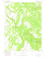
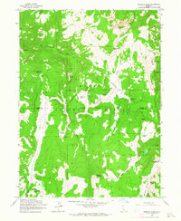
1963 Map of Soup Creek
USGS Topo · Published 1965About this map
Bowman Ranch and a network of remote timber-related sites define this high-altitude landscape within the Modoc National Forest. The map documents a rugged terrain shaped by the tributaries of Fitzhugh Creek and the headwaters of Soup Creek, revealing the infrastructure of early mid-century land use. Loggers and early settlers left their mark at Cantrall Mill and Brooks Mill, while the natural topography is punctuated by distinctive family-named features like Flournoy Swale, Hacker Flat, and Henderson Meadow. The southeastern corner transitions into the more open expanse of Jess Valley, where the drainage of Mill Creek passes over Mill Creek Falls near Clear Lake. This 1963 field-checked survey preserves the layout of primitive transportation, tracing a web of telephone lines and jeep trails that connected isolated mountain outposts before modern infrastructure reached these higher elevations.
Find a feature on this map
68 named features on this map. Tap any name to fly to it.
Don’t see what you’re looking for? This feature index may not catch every label — zoom into the map to look around manually.
Map Details
Editions of this 1963 Soup Creek Map
4 editions found
Other maps of this area

1886 · Alturas
USGS Topo · 1:250,000

1892 · Alturas
USGS Topo · 1:250,000

1954 · Alturas
USGS Topo · 1:250,000

1958 · Alturas
USGS Topo · 1:250,000

1962 · Alturas
USGS Topo · 1:250,000

1962 · Tule Mountain
USGS Topo · 1:24,000

1962 · Jess Valley
USGS Topo · 1:24,000
1962 · Emerson Peak
USGS Topo · 1:24,000

1963 · Warren Peak
USGS Topo · 1:24,000

1963 · Little Juniper Reservoir
USGS Topo · 1:24,000