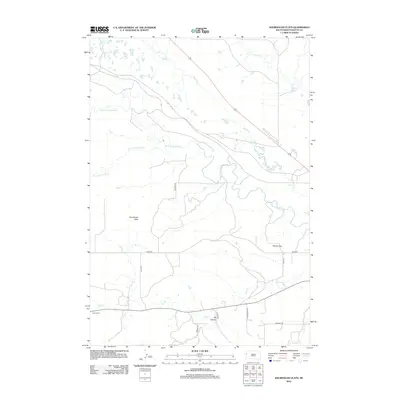
2012 Map of Sourdough Flats
USGS Topo · Published 2012About this map
Sourdough Flats and Windy Flats characterize this high-plains landscape in Butte County, where the meandering course of the Belle Fourche River creates a complex drainage network. The river's path is fed by numerous tributaries, including Middle Cr, Crow Cr, and Grummit Canyon Cr. The geography reflects a sparsely populated ranching environment, anchored by local sites such as the Fuller Ranch and the distinctive geological depression of Big Canyon in the south.
Find a feature on this map
18 named features on this map. Tap any name to fly to it.
Don’t see what you’re looking for? This feature index may not catch every label — zoom into the map to look around manually.
Map Details
Editions of this 2012 Sourdough Flats Map
This is the sole edition of this map. No revisions or reprints were ever made.
Other maps of this area

1901 · Aladdin
USGS Topo · 1:125,000

1903 · Aladdin
USGS Topo · 1:125,000

1905 · Indian
USGS Topo · 1:62,500

1907 · Belle Fourche
USGS Topo · 1:125,000

1907 · Redwater
USGS Topo · 1:62,500

1953 · Rapid City
USGS Topo · 1:250,000

1954 · The Forks
USGS Topo · 1:24,000
1954 · Jolly
USGS Topo · 1:24,000
1954 · Belle Fourche
USGS Topo · 1:24,000

1954 · Gillette
USGS Topo · 1:250,000