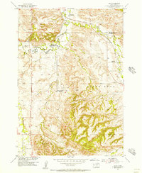
1954 Map of Jolly
USGS Topo · Published 1956About this map
Redwater Creek and the winding Chicago North Western railroad corridor define this mid-century landscape on the border of Butte and Lawrence Counties. The map documents an era of consolidation in rural education, marking several decommissioned local institutions such as White Sch (Abandoned), Todd Sch (Abandoned), and Spring Creek Sch (Abandoned). Industrial activity is centered around the small settlement of Jolly, featuring Clay Pits, the Jolly Dump, and a nearby Powerplant. The terrain transitions from the alluvial bottomlands of False Bottom Creek to the prominent heights of Saint Onge, while several windmills and water tanks suggest a persistent ranching economy. This survey was conducted as part of the Department of the Interior program for the development of the Missouri River Basin.
Find a feature on this map
18 named features on this map. Tap any name to fly to it.
Don’t see what you’re looking for? This feature index may not catch every label — zoom into the map to look around manually.
Map Details
Editions of this 1954 Jolly Map
4 editions found
Other maps of this area

1894 · Deadwood
USGS Topo · 1:125,000

1899 · Sturgis
USGS Topo · 1:62,500

1900 · Spearfish
USGS Topo · 1:62,500

1901 · Deadwood
USGS Topo · 1:125,000

1905 · Saint Onge
USGS Topo · 1:62,500

1907 · Belle Fourche
USGS Topo · 1:125,000

1907 · Redwater
USGS Topo · 1:62,500

1915 · Spearfish
USGS Topo · 1:62,500

1915 · Sturgis
USGS Topo · 1:62,500

1916 · Deadwood
USGS Topo · 1:125,000