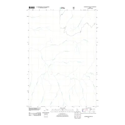
2011 Map of Sourdough Peak
USGS Topo · Published 2011About this map
Sourdough Creek and Johns Creek drain a complex network of high-elevation drainages in this part of Idaho County. The 2011 survey shows a landscape defined by its deep hydrological system, where tributaries like Snoose Creek and Aubion Creek feed into larger watercourses. Human imprint is minimal, represented primarily by the winding path of Sourdough Rd as it traverses the northern terrain. The presence of Twin Lakes Creek and Moores Lake Creek indicates the glacial character of the high country, where small mountain lakes serve as headwaters for the numerous named creeks. This map provides a clear record of the watershed patterns before subsequent landscape changes, documenting the exact flow of streams such as Frank Brown Creek and Boundary Creek near the eastern edge of the quadrangle.
Find a feature on this map
18 named features on this map. Tap any name to fly to it.
Don’t see what you’re looking for? This feature index may not catch every label — zoom into the map to look around manually.
Map Details
Editions of this 2011 Sourdough Peak Map
This is the sole edition of this map. No revisions or reprints were ever made.
Other maps of this area

1931 · Buffalo Hump
USGS Topo · 1:125,000

1934 · Buffalo Hump
USGS Topo · 1:125,000

1956 · Elk City
USGS Topo · 1:250,000

1960 · Elk City
USGS Topo · 1:250,000

1962 · Golden
USGS Topo · 1:24,000

1963 · Sourdough Peak
USGS Topo · 1:24,000

1963 · Hanover Mtn.
USGS Topo · 1:24,000

1963 · Huddleson Bluff
USGS Topo · 1:24,000

1963 · Marble Butte
USGS Topo · 1:24,000
1963 · Hungry Ridge
USGS Topo · 1:24,000