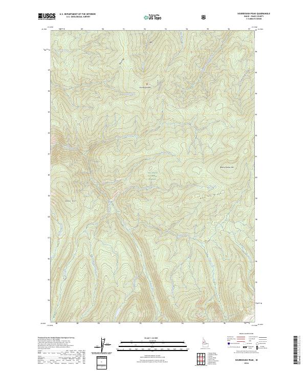
2024 Map of Sourdough Peak
USGS Topo · Published 2024About this map
Sourdough Peak and the high ridges of Idaho County define this landscape within the Nez Perce National Forest. The map detail captures the remote headwaters of numerous drainages, including Johns Creek and Sourdough Creek, flowing through the protected expanse of the Gospel-Hump Wilderness. Significant topographical landmarks such as Baking Powder Mtn, Blue Ridge, and Dome Hill illustrate the complex verticality of this region. Human presence is sparse, marked primarily by the winding Sourdough Rd and several creek-side survey sections. This map provides a detailed view of the natural water systems that feed the larger river networks, from Taylor Creek in the southeast to Snoose Creek in the northwest, offering a precise look at these drainages before they exit the wilderness boundaries.
Find a feature on this map
31 named features on this map. Tap any name to fly to it.
Don’t see what you’re looking for? This feature index may not catch every label — zoom into the map to look around manually.
Map Details
Editions of this 2024 Sourdough Peak Map
This is the sole edition of this map. No revisions or reprints were ever made.
Other maps of this area

1931 · Buffalo Hump
USGS Topo · 1:125,000

1934 · Buffalo Hump
USGS Topo · 1:125,000

1956 · Elk City
USGS Topo · 1:250,000

1960 · Elk City
USGS Topo · 1:250,000

1962 · Golden
USGS Topo · 1:24,000

1963 · Sourdough Peak
USGS Topo · 1:24,000

1963 · Hanover Mtn.
USGS Topo · 1:24,000

1963 · Huddleson Bluff
USGS Topo · 1:24,000

1963 · Marble Butte
USGS Topo · 1:24,000
1963 · Hungry Ridge
USGS Topo · 1:24,000