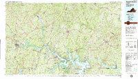
1984 Map of South Boston
USGS Topo · Published 1985About this map
John H Kerr Reservoir dominates the landscape of the Virginia-North Carolina border, its intricate shoreline creating numerous recreation points like the Grassy Creek Recreation Area and Kimball Point State Recreation Area. The Roanoke River flows through the heart of the region, feeding into the massive reservoir and onward to Lake Gaston in the southeast. Industrial and transportation hubs like South Boston and South Hill are connected by a network including the Southern and Seaboard Coast Line railroads, reflecting the area's mid-century logistics and timber economy. Further west, the Banister Lake and Hyco Lake catchments provide additional water resources for the rural communities of Halifax and Mecklenburg Counties. This landscape is a mix of small agricultural settlements like Wylliesburg and Buffalo Junction, interspersed with regional airfields such as Mecklenburg-Brunswick Regional Airport, showing the modernization of Southside Virginia in the early 1980s.
Find a feature on this map
72 named features on this map. Tap any name to fly to it.
Don’t see what you’re looking for? This feature index may not catch every label — zoom into the map to look around manually.
Map Details
Editions of this 1984 South Boston Map
This is the sole edition of this map. No revisions or reprints were ever made.
Other maps of this area

1891 · Farmville
USGS Topo · 1:125,000

1892 · Lynchburg
USGS Topo · 1:125,000

1892 · Appomattox
USGS Topo · 1:125,000

1893 · Farmville
USGS Topo · 1:125,000

1897 · Amelia
USGS Topo · 1:125,000

1918 · Lawrenceville
USGS Topo · 1:62,500

1919 · White Plains
USGS Topo · 1:48,000

1920 · Lawrenceville
USGS Topo · 1:48,000

1920 · White Plains
USGS Topo · 1:62,500

1921 · Lawrenceville
USGS Topo · 1:62,500