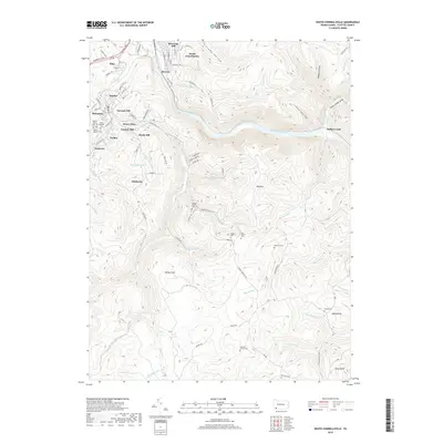
2019 Map of South Connellsville
USGS Topo · Published 2019About this map
South Connellsville and the rugged canyon of the Youghiogheny River define this corner of Fayette County. The map details the transition from industrial and residential clusters like Dunbar, Mahoning, and Furnace Hill in the northwest to the high, wooded ridges of the Laurel Highlands in the southeast. A dense network of family history is preserved through numerous rural burial grounds, including the Hughes Family Cem - 1, Hay Family Cem, and Roebuck Cem. The terrain is marked by dramatic elevation changes, from the depths of Indian Creek Gorge up to Tharp Knob. Former industrial sites and company housing areas such as Brown Row, Factory Hill, and Pechin are documented alongside the Sitka railroad junction, showing the area's deep roots in the regional coal and manufacturing economy.
Find a feature on this map
91 named features on this map. Tap any name to fly to it.
Don’t see what you’re looking for? This feature index may not catch every label — zoom into the map to look around manually.
Map Details
Editions of this 2019 South Connellsville Map
This is the sole edition of this map. No revisions or reprints were ever made.
Other maps of this area

1900 · Uniontown
USGS Topo · 1:62,500

1902 · Connellsville
USGS Topo · 1:62,500

1922 · Confluence
USGS Topo · 1:62,500

1922 · Donegal
USGS Topo · 1:62,500

1931 · Connellsville
USGS Topo · 1:62,500

1931 · Uniontown
USGS Topo · 1:62,500

1931 · Confluence
USGS Topo · 1:62,500

1933 · Confluence
USGS Topo · 1:62,500

1935 · Donegal
USGS Topo · 1:62,500

1936 · Connellsville
USGS Topo · 1:62,500