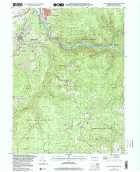
1999 Map of South Connellsville
USGS Topo · Published 2000About this map
The Youghiogheny River cuts a deep path through the highlands of Fayette County, separating Connellsville Ridge from the massive expanse of Chestnut Ridge. This industrial landscape reflects a long history of extraction, evidenced by the numerous Quarries and Strip Mines surrounding the borough of Dunbar. Historic mining settlements and neighborhoods like Furnace Hill, Brown Row, and Factory Hill cluster near the Dunbar Creek valley, where the B & O RR once serviced the local coal and coke operations. South of South Connellsville, much of the terrain is preserved within State Game Lands No 51, while the southeastern corner touches Ohiopyle State Park. Cultural landmarks such as the Iron Furnace and Casparis Caves sit alongside more modern features like the Drive-in Theater in Sitka, showing the evolution of this river-and-rail corridor over the decades.
Find a feature on this map
64 named features on this map. Tap any name to fly to it.
Don’t see what you’re looking for? This feature index may not catch every label — zoom into the map to look around manually.
Map Details
Editions of this 1999 South Connellsville Map
This is the sole edition of this map. No revisions or reprints were ever made.
Other maps of this area

1900 · Uniontown
USGS Topo · 1:62,500

1902 · Connellsville
USGS Topo · 1:62,500

1922 · Confluence
USGS Topo · 1:62,500

1922 · Donegal
USGS Topo · 1:62,500

1931 · Connellsville
USGS Topo · 1:62,500

1931 · Uniontown
USGS Topo · 1:62,500

1931 · Confluence
USGS Topo · 1:62,500

1933 · Confluence
USGS Topo · 1:62,500

1935 · Donegal
USGS Topo · 1:62,500

1936 · Connellsville
USGS Topo · 1:62,500
Featured Places
- South Connellsville, PA
- Dunbar, PA
- Springfield Township, PA
- Reservoir Hill, PA
- Connellsville Township, PA