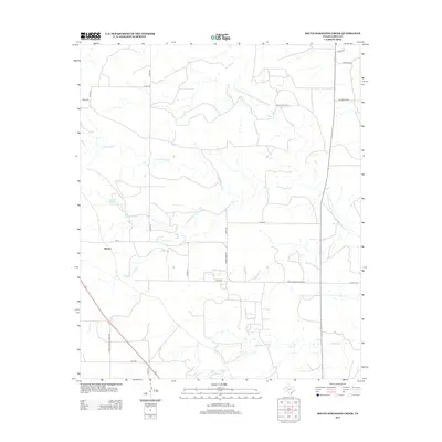
2012 Map of South Dokegood Creek
USGS Topo · Published 2012About this map
The settlement of Buenos stands as a primary landmark in this section of Garza County, where the landscape is defined by the dendritic drainage patterns of the N Fork Double Mountain Fork Brazos River. This semi-arid region is etched by several significant seasonal waterways, including N Dokegood Cr, S Dokegood Cr, and Falls Cr, which carve through the plains. The road network reflects a structured ranching and agricultural economy, with several family-named thoroughfares such as Rains Ranch Rd, Mc Donald Rd, and Red Sims Rd providing access to the interior. Major transportation arteries like Farm-To-Market Road 211 and Farm-To-Market Road 399 intersect the area, connecting the small community of Buenos to the wider Texas High Plains region during the early twenty-first century.
Find a feature on this map
22 named features on this map. Tap any name to fly to it.
Don’t see what you’re looking for? This feature index may not catch every label — zoom into the map to look around manually.
Map Details
Editions of this 2012 South Dokegood Creek Map
This is the sole edition of this map. No revisions or reprints were ever made.
Other maps of this area

1954 · Lubbock
USGS Topo · 1:250,000

1965 · Southland
USGS Topo · 1:24,000

1965 · Slaton NE
USGS Topo · 1:24,000

1966 · Cap Rock
USGS Topo · 1:24,000

1966 · Canyon Valley
USGS Topo · 1:24,000

1968 · South Dokegood Creek
USGS Topo · 1:24,000

1969 · Cap Rock SE
USGS Topo · 1:24,000

1969 · Post East
USGS Topo · 1:24,000

1969 · Post West
USGS Topo · 1:24,000

1970 · Grassland
USGS Topo · 1:24,000