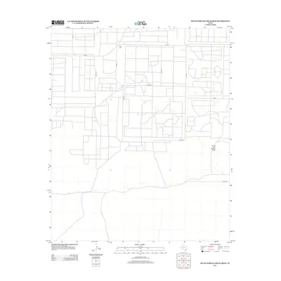
2012 Map of South Fork Sulphur Draw
USGS Topo · Published 2012About this map
Dean Ranch stands as a prominent landmark in this portion of Cochran County, reflecting the enduring legacy of large-scale cattle ranching and land management in the Texas Panhandle. The landscape is defined by the ephemeral passage of the South Fork Sulphur Draw, a drainage feature that meanders across the southern portion of the quadrangle. This 2012 survey illustrates a highly organized grid of rural infrastructure, where local routes like CO Hwy-240 and CO Hwy-260 intersect with state-maintained roads including FM-1585 and FM-301. The map reveals the transition between open range and the systematic division of agricultural tracts, providing a clear view of the modern land-use patterns that have shaped this region of West Texas.
Find a feature on this map
12 named features on this map. Tap any name to fly to it.
Don’t see what you’re looking for? This feature index may not catch every label — zoom into the map to look around manually.
Map Details
Editions of this 2012 South Fork Sulphur Draw Map
This is the sole edition of this map. No revisions or reprints were ever made.
Other maps of this area

1954 · Brownfield
USGS Topo · 1:250,000

1958 · Brownfield
USGS Topo · 1:250,000

1962 · Brownfield
USGS Topo · 1:250,000

1965 · Plains 1 NE
USGS Topo · 1:24,000

1965 · Whiteface
USGS Topo · 1:24,000

1969 · Plains 1 SE
USGS Topo · 1:24,000

1969 · Lehman
USGS Topo · 1:24,000

1970 · Plains 1 SW
USGS Topo · 1:24,000

1970 · Whiteface SW
USGS Topo · 1:24,000

1970 · Plains 1 NW
USGS Topo · 1:24,000