
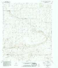
1970 Map of Plains 1 NW
USGS Topo · Published 1974About this map
The Levelland and Slaughter Oil and Gas Field dominates this West Texas landscape, revealing an intensive network of energy extraction near the border of Cochran and Yoakum counties. A vast grid of oil and gas wells, interconnected by an intricate web of pipelines, illustrates the mid-century industrialization of the High Plains. Natural drainage patterns are defined by the winding courses of Sulphur Draw and its South Fork, which provide the primary topographic relief in an otherwise flat, systematic terrain. Cultural landmarks are sparse but significant to the era's local history, including the WT Slaughter Pumping Sta and the Dean Ranch. Minor operations like a Gravel Pit and several Water Tanks further support the infrastructure of this resource-heavy region, while the small settlement of Duggan stands as a quiet point of human habitation amidst the expansive oil fields.
Find a feature on this map
10 named features on this map. Tap any name to fly to it.
Don’t see what you’re looking for? This feature index may not catch every label — zoom into the map to look around manually.
Map Details
Editions of this 1970 Plains 1 NW Map
2 editions found
Other maps of this area

1954 · Brownfield
USGS Topo · 1:250,000

1958 · Brownfield
USGS Topo · 1:250,000

1962 · Brownfield
USGS Topo · 1:250,000

1965 · Plains 1 NE
USGS Topo · 1:24,000

1965 · Whiteface
USGS Topo · 1:24,000

1969 · Plains 1 SE
USGS Topo · 1:24,000

1969 · Lehman
USGS Topo · 1:24,000

1970 · Plains 1 SW
USGS Topo · 1:24,000

1970 · Whiteface SW
USGS Topo · 1:24,000

1971 · Schooler Ranch
USGS Topo · 1:24,000