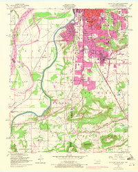
1948 Map of South Fort Smith
USGS Topo · Published 1971About this map
The Poteau River winds along the border of Oklahoma and Arkansas, carving a path between the growing urban center of South Fort Smith and the neighboring settlements of Arkoma and Pocola. This mid-century landscape is defined by its transition from industrial and rail hubs to the prominent ridgelines of George Mountain and White Bluff Mountain. Educational and religious institutions are well-documented, including the St Scholastica Academy and the White Bluff Church, alongside numerous local schools like South Side High Sch and Orr Sch. The map reveals the industrial footprint of the era through a saw mill, strip mines, and several borrow pits, while the Missouri Pacific and St Louis San Francisco railroads trace the movement of goods and people through the river valley.
Find a feature on this map
53 named features on this map. Tap any name to fly to it.
Don’t see what you’re looking for? This feature index may not catch every label — zoom into the map to look around manually.
Map Details
Editions of this 1948 South Fort Smith Map
3 editions found
Other maps of this area

1879 · Fort Smith
USGS Topo · 1:62,500

1887 · Van Buren
USGS Topo · 1:62,500

1887 · Greenwood
USGS Topo · 1:62,500

1890 · Fort Smith
USGS Topo · 1:125,000

1900 · Sallisaw
USGS Topo · 1:125,000

1911 · Sallisaw
USGS Topo · 1:125,000

1943 · Fort Smith
USGS Topo · 1:125,000

1946 · Fort Smith
USGS Topo · 1:250,000

1947 · Van Buren
USGS Topo · 1:62,500

1947 · Greenwood
USGS Topo · 1:62,500