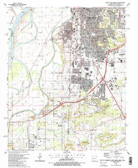
1987 Map of South Fort Smith
USGS Topo · Published 1988About this map
Fort Smith and its southern suburbs are captured during a period of late 20th-century expansion, where the urban grid meets the industrial and agricultural landscape of the borderlands. The confluence of the Arkansas River and the Poteau River serves as a natural divide, with Arkoma and Pocola situated just across the state line in Oklahoma. The map reveals a mix of established community institutions, such as St Scholastica Academy and South Side High Sch, alongside signs of the region's resource extraction economy, including a Quarry, Claypit, and Shale Pit.
Find a feature on this map
75 named features on this map. Tap any name to fly to it.
Don’t see what you’re looking for? This feature index may not catch every label — zoom into the map to look around manually.
Map Details
Editions of this 1987 South Fort Smith Map
2 editions found
Other maps of this area

1879 · Fort Smith
USGS Topo · 1:62,500

1887 · Van Buren
USGS Topo · 1:62,500

1887 · Greenwood
USGS Topo · 1:62,500

1890 · Fort Smith
USGS Topo · 1:125,000

1900 · Sallisaw
USGS Topo · 1:125,000

1911 · Sallisaw
USGS Topo · 1:125,000

1943 · Fort Smith
USGS Topo · 1:125,000

1946 · Fort Smith
USGS Topo · 1:250,000

1947 · Van Buren
USGS Topo · 1:62,500

1947 · Greenwood
USGS Topo · 1:62,500