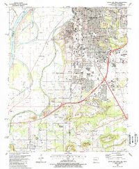
1987 Map of South Fort Smith
USGS Topo · Published 1988About this map
The Arkansas River and Poteau River define the borderlands of the late 1980s, where the city of Fort Smith extends southward toward the prominent elevations of George Mountain and Brooks Mountain. This period shows a complex mix of industrial and suburban development, with numerous gas wells and claypits dotting the landscape around South Fort Smith and Cavanaugh. The map captures the significant crossing of Interstate 40 as it bridges the state line between Oklahoma and Arkansas, linking Arkoma and Pocola to the urban center.
Find a feature on this map
55 named features on this map. Tap any name to fly to it.
Don’t see what you’re looking for? This feature index may not catch every label — zoom into the map to look around manually.
Map Details
Editions of this 1987 South Fort Smith Map
2 editions found
Other maps of this area

1879 · Fort Smith
USGS Topo · 1:62,500

1887 · Van Buren
USGS Topo · 1:62,500

1887 · Greenwood
USGS Topo · 1:62,500

1890 · Fort Smith
USGS Topo · 1:125,000

1900 · Sallisaw
USGS Topo · 1:125,000

1911 · Sallisaw
USGS Topo · 1:125,000

1943 · Fort Smith
USGS Topo · 1:125,000

1946 · Fort Smith
USGS Topo · 1:250,000

1947 · Van Buren
USGS Topo · 1:62,500

1947 · Greenwood
USGS Topo · 1:62,500