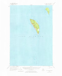
1956 Map of South Fox Island
USGS Topo · Published 1976About this map
South Fox Island and North Fox Island emerge from the depths of Lake Michigan in this mid-century hydrographic and topographic study. Part of Leelanau Twp, these isolated landmasses are defined by their maritime importance and navigational hazards. The southern tip of the larger island is anchored by the South Fox Island Lighthouse, a critical beacon for vessels navigating the nearby South Fox Island Shoals. The presence of a Landing Field on the eastern shore of South Fox Island indicates the remote island's reliance on aerial transport during the 1950s. The map meticulously details the surrounding bathymetry, showing the submerged ridges and varying depths that characterize this portion of the Manitou Passage area.
Find a feature on this map
7 named features on this map. Tap any name to fly to it.
Don’t see what you’re looking for? This feature index may not catch every label — zoom into the map to look around manually.
Map Details
Editions of this 1956 South Fox Island Map
2 editions found
Other maps of this area

1954 · Escanaba
USGS Topo · 1:250,000

1955 · Gull Island
USGS Topo · 1:62,500

1955 · Cheboygan
USGS Topo · 1:250,000

1956 · North Manitou
USGS Topo · 1:62,500

1956 · South Fox Island
USGS Topo · 1:62,500

1956 · Beaver Island
USGS Topo · 1:62,500

1957 · Escanaba
USGS Topo · 1:250,000

1957 · Northport
USGS Topo · 1:62,500

1958 · Escanaba
USGS Topo · 1:250,000

1958 · Cheboygan
USGS Topo · 1:250,000