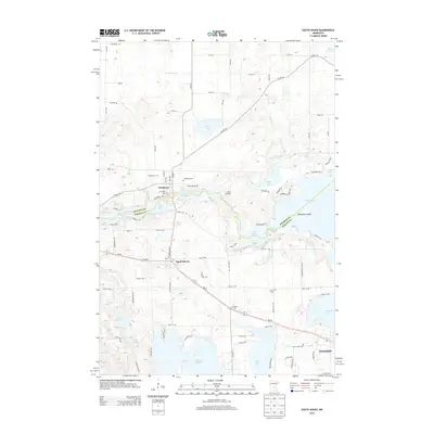
2013 Map of South Haven
USGS Topo · Published 2013About this map
Clearwater River winds across this central Minnesota landscape, serving as the border between Stearns and Wright counties. This 2013 survey illustrates a region defined by its glacial lakes and transition from agricultural fields to water-front settlements. The village of South Haven occupies a central position along MN-55, while the town of Annandale is situated in the southeastern corner near the shores of Lake John.
Find a feature on this map
63 named features on this map. Tap any name to fly to it.
Don’t see what you’re looking for? This feature index may not catch every label — zoom into the map to look around manually.
Map Details
Editions of this 2013 South Haven Map
This is the sole edition of this map. No revisions or reprints were ever made.
Other maps of this area

1951 · Annandale
USGS Topo · 1:62,500

1953 · Saint Cloud
USGS Topo · 1:250,000

1957 · Saint Cloud
USGS Topo · 1:250,000

1958 · Saint Cloud
USGS Topo · 1:250,000

1958 · Dassel
USGS Topo · 1:62,500

1958 · Cokato
USGS Topo · 1:62,500

1967 · Rockville
USGS Topo · 1:24,000

1967 · Kimball
USGS Topo · 1:24,000
1974 · St Augusta
USGS Topo · 1:24,000
1974 · Annandale
USGS Topo · 1:24,000