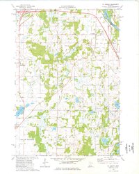
1974 Map of St Augusta
USGS Topo · Published 1976About this map
The Mississippi River winds through the northeast corner of this Stearns County landscape, serving as the historical boundary between Haven and St Augusta townships. Small agricultural centers like Luxemburg and St Augusta anchor a countryside defined by glacial topography, where numerous Gravel Pits reflect the local geology. In the southern portion of the map, the terrain is dotted with small water bodies including Beaver Lake, Mund Lake, and Hulbert Lake, while the settlement of Hurrle sits near the border of Fairhaven and Maine Prairie. Local genealogy is well-documented through landmarks like St Marys Cem and Gethsemane Cem. Industrial infrastructure is visible along the river corridor, where the Burlington Northern railroad runs parallel to new highway segments marked as Under Construction, illustrating the mid-1970s transition toward modern transit networks.
Find a feature on this map
27 named features on this map. Tap any name to fly to it.
Don’t see what you’re looking for? This feature index may not catch every label — zoom into the map to look around manually.
Map Details
Editions of this 1974 St Augusta Map
This is the sole edition of this map. No revisions or reprints were ever made.
Other maps of this area

1950 · St. Cloud
USGS Topo · 1:62,500

1951 · Annandale
USGS Topo · 1:62,500

1953 · Saint Cloud
USGS Topo · 1:250,000

1957 · Saint Cloud
USGS Topo · 1:250,000

1958 · Saint Cloud
USGS Topo · 1:250,000

1965 · St Joseph
USGS Topo · 1:24,000

1967 · Rockville
USGS Topo · 1:24,000

1967 · Kimball
USGS Topo · 1:24,000
1974 · Cable
USGS Topo · 1:24,000
1974 · Annandale
USGS Topo · 1:24,000
Featured Places
- St. Cloud, MN
- Saint Augusta, St. Augusta
- Luxemburg, St. Augusta
- Lynden Township, MN
- Fair Haven Township, MN