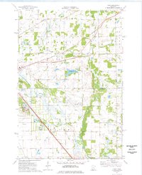
1974 Map of Cable
USGS Topo · Published 1976About this map
The St Cloud Municipal Airport and the sprawling grounds of the State Reformatory anchor this mid-1970s landscape where the rural townships of Minden and Haven meet. The area is defined by the sharp diagonal of the Burlington Northern railroad, which parallels the small settlement of Cable. This transport corridor cuts across a landscape heavily shaped by civil engineering and drainage, evidenced by the prominent network of the County Ditch 10 and County Ditch 17 systems.
Find a feature on this map
26 named features on this map. Tap any name to fly to it.
Don’t see what you’re looking for? This feature index may not catch every label — zoom into the map to look around manually.
Map Details
Editions of this 1974 Cable Map
2 editions found
Other maps of this area

1950 · St. Cloud
USGS Topo · 1:62,500

1951 · Annandale
USGS Topo · 1:62,500

1953 · Saint Cloud
USGS Topo · 1:250,000

1953 · Stillwater
USGS Topo · 1:250,000

1955 · Stillwater
USGS Topo · 1:250,000

1957 · Saint Cloud
USGS Topo · 1:250,000

1958 · Stillwater
USGS Topo · 1:250,000

1958 · Saint Cloud
USGS Topo · 1:250,000

1961 · Clear Lake
USGS Topo · 1:24,000

1961 · Monticello
USGS Topo · 1:62,500