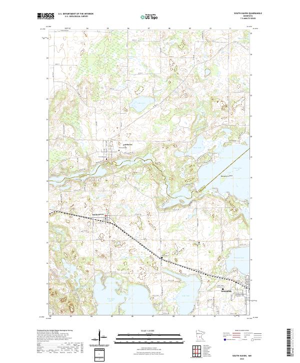
2022 Map of South Haven
USGS Topo · Published 2022About this map
Fairhaven and South Haven anchor this landscape along the Stearns Co Wright Co line, where the winding Clearwater River connects a complex network of glacial lakes. The area is defined by its water bodies, including the large East Lake Sylvia and Clearwater Lake, which features the distinctive Bungalow Island. Local genealogy is well-supported by several established burial grounds such as Fairhaven Cem, Concordia Cem, and Saint Johns Lutheran Cem near the town of Annandale. The road network, including Co Hwy 45 and Co Hwy 39, reveals the rural settlement patterns typical of central Minnesota, with numerous secondary routes like 90th St NW providing access to waterfront properties and small agricultural tracts between Otter Lake and Lake John.
Find a feature on this map
66 named features on this map. Tap any name to fly to it.
Don’t see what you’re looking for? This feature index may not catch every label — zoom into the map to look around manually.
Map Details
Editions of this 2022 South Haven Map
This is the sole edition of this map. No revisions or reprints were ever made.
Other maps of this area

1951 · Annandale
USGS Topo · 1:62,500

1953 · Saint Cloud
USGS Topo · 1:250,000

1957 · Saint Cloud
USGS Topo · 1:250,000

1958 · Saint Cloud
USGS Topo · 1:250,000

1958 · Dassel
USGS Topo · 1:62,500

1958 · Cokato
USGS Topo · 1:62,500

1967 · Rockville
USGS Topo · 1:24,000

1967 · Kimball
USGS Topo · 1:24,000
1974 · St Augusta
USGS Topo · 1:24,000
1974 · Annandale
USGS Topo · 1:24,000