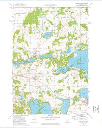
1974 Map of South Haven
USGS Topo · Published 1976About this map
The Clearwater River serves as a natural boundary between Stearns and Wright counties in this mid-1970s topographical record. The settlement pattern is anchored by Fairhaven, South Haven, and the western edge of Annandale, showing a landscape defined by the Soo Line railroad and a dense network of glacial lakes. Local genealogy is well-served by the inclusion of several burying grounds, including Concordia Cem, Zion Cem, Union Cem, and St Johns Cem.
Find a feature on this map
41 named features on this map. Tap any name to fly to it.
Don’t see what you’re looking for? This feature index may not catch every label — zoom into the map to look around manually.
Map Details
Editions of this 1974 South Haven Map
This is the sole edition of this map. No revisions or reprints were ever made.
Other maps of this area

1951 · Annandale
USGS Topo · 1:62,500

1953 · Saint Cloud
USGS Topo · 1:250,000

1957 · Saint Cloud
USGS Topo · 1:250,000

1958 · Saint Cloud
USGS Topo · 1:250,000

1958 · Dassel
USGS Topo · 1:62,500

1958 · Cokato
USGS Topo · 1:62,500

1967 · Rockville
USGS Topo · 1:24,000

1967 · Kimball
USGS Topo · 1:24,000
1974 · St Augusta
USGS Topo · 1:24,000
1974 · Annandale
USGS Topo · 1:24,000