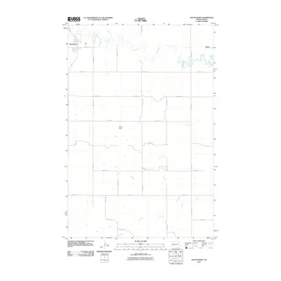
2011 Map of South Heart
USGS Topo · Published 2011About this map
South Heart and the nearby siding of Eland are the primary points of interest on this high-plains landscape, where the meandering Heart River flows eastward across Stark County. The river is joined from the north by North Creek, while the southern portion of the quadrangle is defined by the extensive drainage network of Ash Creek. A prominent geological feature, White Butte, stands as a local landmark amidst the systematic grid of rural roads. This 2011 survey documents the established agricultural layout of the region, anchored by the transportation corridor of Main Ave E and the north-south axis of 121st Ave SW. The map provides a clear view of the relationship between the town's early 21st-century development and the natural watercourses that shaped its settlement history.
Find a feature on this map
21 named features on this map. Tap any name to fly to it.
Don’t see what you’re looking for? This feature index may not catch every label — zoom into the map to look around manually.
Map Details
Editions of this 2011 South Heart Map
This is the sole edition of this map. No revisions or reprints were ever made.
Other maps of this area

1953 · Dickinson
USGS Topo · 1:250,000

1957 · Dickinson
USGS Topo · 1:250,000

1959 · Dickinson North
USGS Topo · 1:24,000

1959 · Dickinson South
USGS Topo · 1:24,000

1961 · Daglum
USGS Topo · 1:62,500

1962 · Belfield NE
USGS Topo · 1:24,000

1962 · Belfield SE
USGS Topo · 1:24,000

1973 · New Hradec South
USGS Topo · 1:24,000

1973 · New England NW
USGS Topo · 1:24,000

1973 · Schefield
USGS Topo · 1:24,000