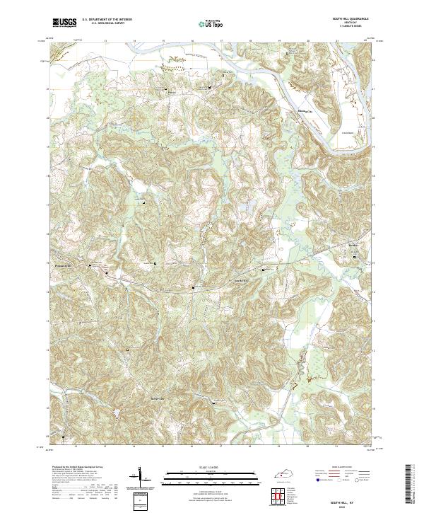
2022 Map of South Hill
USGS Topo · Published 2022About this map
The Green River meanders through the northern portion of this Butler County landscape, carving out the prominent Little Bend and serving as the historical boundary between Ohio and Butler counties. Small communities and named crossroads such as Provo, Mining City, and Dunbar are scattered across the dissected terrain, connected by a network of rural roads like Rochester Rd and Mine City Rd. The area is characterized by a dense distribution of family and community cemeteries, including the Dick Green Cem, Doolin-Rone Cem, and Doc Gardner Cem, which provide significant genealogical touchstones for the region.
Find a feature on this map
79 named features on this map. Tap any name to fly to it.
Don’t see what you’re looking for? This feature index may not catch every label — zoom into the map to look around manually.
Map Details
Editions of this 2022 South Hill Map
This is the sole edition of this map. No revisions or reprints were ever made.
Other maps of this area

1909 · Hartford
USGS Topo · 1:62,500

1911 · Dunmor
USGS Topo · 1:48,000

1914 · Little Muddy
USGS Topo · 1:62,500

1914 · Dunmor
USGS Topo · 1:62,500

1925 · Spring Lick
USGS Topo · 1:62,500

1953 · Dunmor
USGS Topo · 1:24,000

1953 · South Hill
USGS Topo · 1:24,000

1953 · Quality
USGS Topo · 1:24,000

1953 · Rochester
USGS Topo · 1:24,000

1954 · Evansville
USGS Topo · 1:250,000