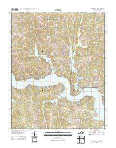
2013 Map of South Hill SE
USGS Topo · Published 2013About this map
Lake Gaston dominates the southern half of this landscape, its expansive waters and intricate shoreline defining the residential and recreational layout of the region. The map illustrates a high density of private drives and neighborhood roads that follow the lake's fingers, including names like Cannons Ferry Rd and Nelsons Dr, highlighting the area's development around the reservoir. Inland, the terrain is characterized by a network of creeks such as Great Cr and Miles Cr that feed into the basin.
Find a feature on this map
160 named features on this map. Tap any name to fly to it.
Don’t see what you’re looking for? This feature index may not catch every label — zoom into the map to look around manually.
Map Details
Editions of this 2013 South Hill SE Map
This is the sole edition of this map. No revisions or reprints were ever made.
Other maps of this area

1919 · White Plains
USGS Topo · 1:48,000

1920 · White Plains
USGS Topo · 1:62,500

1953 · Norfolk
USGS Topo · 1:250,000

1953 · Greensboro
USGS Topo · 1:250,000

1954 · Greensboro
USGS Topo · 1:250,000

1962 · Greensboro
USGS Topo · 1:250,000

1963 · Gasburg
USGS Topo · 1:24,000

1963 · White Plains
USGS Topo · 1:24,000

1966 · Greensboro
USGS Topo · 1:250,000

1968 · South Hill SE
USGS Topo · 1:24,000