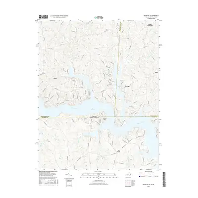
2016 Map of South Hill SE
USGS Topo · Published 2016About this map
Lake Gaston dominates the center of this landscape, where the Roanoke River crosses the border between Virginia and North Carolina. The map documents a contemporary network of residential development and recreation along the shoreline, particularly near the community of Bracey and the Nocarva Airport. Numerous smaller waterways such as Great Creek, Sixpound Creek, and Hawtree Creek feed into the reservoir, carving a complex series of inlets and peninsulas that define the local geography.
Find a feature on this map
144 named features on this map. Tap any name to fly to it.
Don’t see what you’re looking for? This feature index may not catch every label — zoom into the map to look around manually.
Map Details
Editions of this 2016 South Hill SE Map
This is the sole edition of this map. No revisions or reprints were ever made.
Other maps of this area

1919 · White Plains
USGS Topo · 1:48,000

1920 · White Plains
USGS Topo · 1:62,500

1953 · Norfolk
USGS Topo · 1:250,000

1953 · Greensboro
USGS Topo · 1:250,000

1954 · Greensboro
USGS Topo · 1:250,000

1962 · Greensboro
USGS Topo · 1:250,000

1963 · Gasburg
USGS Topo · 1:24,000

1963 · White Plains
USGS Topo · 1:24,000

1966 · Greensboro
USGS Topo · 1:250,000

1968 · South Hill SE
USGS Topo · 1:24,000