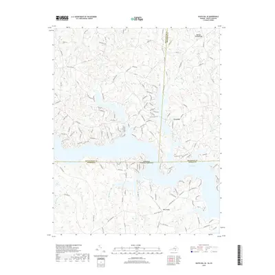
2019 Map of South Hill SE
USGS Topo · Published 2019About this map
Lake Gaston dominates this modern survey of the borderlands where Virginia meets North Carolina, marking a landscape defined by expansive waters and finger-like inlets. The inundation of the Roanoke River valley has created a complex shoreline that reshaped local geography, though the underlying terrain still follows the drainage patterns of Miles Cr, Sixpound Cr, and Hagood Cr. Small rural settlements like Barker Crossroads and Joyceville persist along the northern ridges, while Five Forks serves as a navigational landmark south of the lake. Roads such as Hwy 903 and Cannons Ferry Rd provide access to the waterfront developments and rural tracts that characterize the region today. The map clearly delineates the convergence of four counties—Mecklenburg and Brunswick in Virginia, and Warren and Brunswick in North Carolina—illustrating how these political boundaries intersect within the reservoir itself.
Find a feature on this map
145 named features on this map. Tap any name to fly to it.
Don’t see what you’re looking for? This feature index may not catch every label — zoom into the map to look around manually.
Map Details
Editions of this 2019 South Hill SE Map
This is the sole edition of this map. No revisions or reprints were ever made.
Other maps of this area

1919 · White Plains
USGS Topo · 1:48,000

1920 · White Plains
USGS Topo · 1:62,500

1953 · Norfolk
USGS Topo · 1:250,000

1953 · Greensboro
USGS Topo · 1:250,000

1954 · Greensboro
USGS Topo · 1:250,000

1962 · Greensboro
USGS Topo · 1:250,000

1963 · Gasburg
USGS Topo · 1:24,000

1963 · White Plains
USGS Topo · 1:24,000

1966 · Greensboro
USGS Topo · 1:250,000

1968 · South Hill SE
USGS Topo · 1:24,000