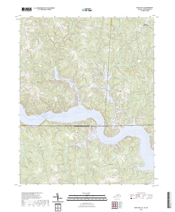
2022 Map of South Hill SE
USGS Topo · Published 2022About this map
Lake Gaston dominates this modern landscape, spanning the state line between Mecklenburg County, Virginia, and Warren County, North Carolina. This map illustrates the heavily indented shoreline and peninsula-based residential developments that define the area, connected by thoroughfares like State Rte 903 and Wise Five Forks Rd. While recreation and lakefront living are prominent, the map preserves older inland identities at Bracey, Joyceville, and Five Forks.
Find a feature on this map
133 named features on this map. Tap any name to fly to it.
Don’t see what you’re looking for? This feature index may not catch every label — zoom into the map to look around manually.
Map Details
Editions of this 2022 South Hill SE Map
This is the sole edition of this map. No revisions or reprints were ever made.
Other maps of this area

1919 · White Plains
USGS Topo · 1:48,000

1920 · White Plains
USGS Topo · 1:62,500

1953 · Norfolk
USGS Topo · 1:250,000

1953 · Greensboro
USGS Topo · 1:250,000

1954 · Greensboro
USGS Topo · 1:250,000

1962 · Greensboro
USGS Topo · 1:250,000

1963 · Gasburg
USGS Topo · 1:24,000

1963 · White Plains
USGS Topo · 1:24,000

1966 · Greensboro
USGS Topo · 1:250,000

1968 · South Hill SE
USGS Topo · 1:24,000