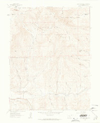
1960 Map of South Mamm Peak
USGS Topo · Published 1964About this map
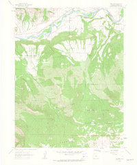
Battlement Mesa and the surrounding high-altitude terrain of the White River National Forest dominate this landscape, which straddles the border between Garfield and Mesa counties. The mapping highlights a transition from the prominent summits of South Mamm Peak and Little Baldy down to the creek-carved lowlands where early development took root. A former community presence is marked at Heiberger (Site), located near the confluence of Standup Gulch and Buzzard Creek. Infrastructure of the early 1960s is represented by a Radio Tower, Gas Well sites, and a Gaging Sta on Brush Creek. The presence of the Clover Sch on Plateau Peninsula suggests a small, dispersed ranching or homesteading community. Connectivity throughout this remote area relies on a network of Pack Trails, Jeep Trails, and the historic Battlement Trail.
Find a feature on this map
42 named features on this map. Tap any name to fly to it.
Don’t see what you’re looking for? This feature index may not catch every label — zoom into the map to look around manually.
Map Details
Editions of this 1960 South Mamm Peak Map
4 editions found
Other maps of this area

1955 · Collbran
USGS Topo · 1:24,000

1955 · The Meadows
USGS Topo · 1:24,000

1957 · Leadville
USGS Topo · 1:250,000

1959 · Leadville
USGS Topo · 1:250,000

1960 · Leadville
USGS Topo · 1:250,000

1960 · North Mamm Peak
USGS Topo · 1:24,000
1960 · Hawxhurst Creek
USGS Topo · 1:24,000

1960 · South Mamm Peak
USGS Topo · 1:24,000
1960 · Rulison
USGS Topo · 1:24,000

1961 · Porter Mountain
USGS Topo · 1:24,000