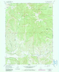
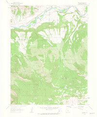
1960 Map of South Mamm Peak
USGS Topo · Published 1984About this map
South Mamm Peak towers over a landscape defined by the intersection of the White River National Forest and Grand Mesa National Forest. The map documents a rugged high-altitude transition where steep ridges like Battlement Mesa and Bald Mountain drop toward the drainage basin of Buzzard Creek. The southern portion of the sheet reveals the traces of early livestock and agricultural activity, specifically around the Clover Sch and the Heiberger (Site) near Horse Gulch. This 1960 field-checked survey preserves the layout of local infrastructure before late-century changes, showing the Clover Sch Road and numerous pack trails such as the Battlement Trail. Notable landmarks like Spruce Point and its radio tower overlook a complex system of gulches and creeks, including Collier Creek and Bloss Creek, which shaped the movement and settlement patterns of this part of Mesa County.
Find a feature on this map
52 named features on this map. Tap any name to fly to it.
Don’t see what you’re looking for? This feature index may not catch every label — zoom into the map to look around manually.
Map Details
Editions of this 1960 South Mamm Peak Map
4 editions found
Other maps of this area

1955 · Collbran
USGS Topo · 1:24,000

1955 · The Meadows
USGS Topo · 1:24,000

1957 · Leadville
USGS Topo · 1:250,000

1959 · Leadville
USGS Topo · 1:250,000

1960 · Leadville
USGS Topo · 1:250,000

1960 · North Mamm Peak
USGS Topo · 1:24,000
1960 · Hawxhurst Creek
USGS Topo · 1:24,000

1960 · South Mamm Peak
USGS Topo · 1:24,000
1960 · Rulison
USGS Topo · 1:24,000

1961 · Porter Mountain
USGS Topo · 1:24,000