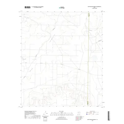
2019 Map of South Mustang Draw SE
USGS Topo · Published 2019About this map
South Mustang Draw and a complex network of ephemeral watercourses define this West Texas landscape along the high divide between the Concho and Colorado River watersheds. The terrain is marked by deep erosional features like Big Jim Draw and Isaac Draw, which reveal the underlying drainage patterns of Irion and Reagan counties. The jurisdictional boundary between Reagan and Irion counties runs north-to-south through the eastern portion of the sheet, cutting across the upper reaches of West Hollow. Transportation in this ranching country is dictated by the rugged topography, with local routes such as Rocker B Ln and Rocky Rd providing access to the remote uplands and draws. This modern survey illustrates the persistent importance of natural drainage features in an arid environment, where names like Antelope Draw and Lewis Draw serve as primary geographic markers.
Find a feature on this map
11 named features on this map. Tap any name to fly to it.
Don’t see what you’re looking for? This feature index may not catch every label — zoom into the map to look around manually.
Map Details
Editions of this 2019 South Mustang Draw SE Map
This is the sole edition of this map. No revisions or reprints were ever made.
Other maps of this area

1920 · Big Lake
USGS Topo · 1:62,500

1920 · Barnhart
USGS Topo · 1:62,500

1921 · Ketchum Mountain
USGS Topo · 1:62,500

1922 · Big Lake
USGS Topo · 1:62,500

1922 · Barnhart
USGS Topo · 1:62,500

1923 · Ketchum Mountain
USGS Topo · 1:62,500

1954 · San Angelo
USGS Topo · 1:250,000

1958 · San Angelo
USGS Topo · 1:250,000

1965 · San Angelo
USGS Topo · 1:250,000

1970 · South Mustang Draw SE
USGS Topo · 1:24,000