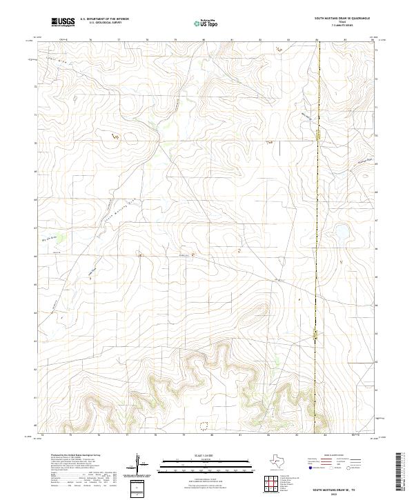
2022 Map of South Mustang Draw SE
USGS Topo · Published 2022About this map
The Rocker B Ranch territory dominates this expanse of the West Texas divide, where the open rangeland is defined by an intricate network of seasonal drainage channels. The landscape is carved by the South Mustang Draw and its various tributaries, including Lewis Draw, Isaac Draw, and Big Jim Draw. This 2022 survey illustrates the modern cattle ranching infrastructure that persists across the Reagan and Irion county line. Private ranch roads like Rocker B Ln and N Entrance Rd provide access through the rolling terrain, while Antelope Draw and West Hollow mark the natural breaks in the high plains. The map offers a precise view of contemporary land use in a region where water management and vast acreage remain the primary drivers of the local economy.
Find a feature on this map
11 named features on this map. Tap any name to fly to it.
Don’t see what you’re looking for? This feature index may not catch every label — zoom into the map to look around manually.
Map Details
Editions of this 2022 South Mustang Draw SE Map
This is the sole edition of this map. No revisions or reprints were ever made.
Other maps of this area

1920 · Big Lake
USGS Topo · 1:62,500

1920 · Barnhart
USGS Topo · 1:62,500

1921 · Ketchum Mountain
USGS Topo · 1:62,500

1922 · Big Lake
USGS Topo · 1:62,500

1922 · Barnhart
USGS Topo · 1:62,500

1923 · Ketchum Mountain
USGS Topo · 1:62,500

1954 · San Angelo
USGS Topo · 1:250,000

1958 · San Angelo
USGS Topo · 1:250,000

1965 · San Angelo
USGS Topo · 1:250,000

1970 · South Mustang Draw SE
USGS Topo · 1:24,000