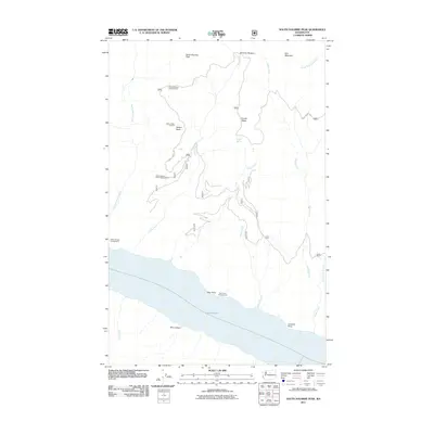
2011 Map of South Navarre Peak
USGS Topo · Published 2011About this map
Lake Chelan dominates the southern reaches of this mountain landscape, providing a deep-water landmark for the surrounding high country. The terrain is defined by dramatic elevation changes from the shoreline up to peaks like South Navarre Peak and Nelson Butte. Access through the area is largely defined by the Grade Creek Rd and a network of drainages including Falls Creek and Camas Creek. Human presence is primarily represented by recreational and observational sites, such as the Nelson Butte Lookout and several high-altitude staging areas like the South Navarre Campground. Near the water, landmarks such as Limekiln Point and Box Canyon emphasize the sharp verticality of the lake's edge. This map documents the intersection of high-elevation forest management and lakeside geography as it existed in the early 21st century.
Find a feature on this map
24 named features on this map. Tap any name to fly to it.
Don’t see what you’re looking for? This feature index may not catch every label — zoom into the map to look around manually.
Map Details
Editions of this 2011 South Navarre Peak Map
This is the sole edition of this map. No revisions or reprints were ever made.
Other maps of this area

1899 · Methow
USGS Topo · 1:125,000

1901 · Chelan
USGS Topo · 1:125,000

1901 · Methow
USGS Topo · 1:125,000

1955 · Concrete
USGS Topo · 1:250,000

1957 · Wenatchee
USGS Topo · 1:250,000

1958 · Concrete
USGS Topo · 1:250,000

1962 · Concrete
USGS Topo · 1:250,000

1968 · South Navarre Peak
USGS Topo · 1:24,000
1968 · Big Goat Mtn
USGS Topo · 1:24,000
1968 · Stormy Mtn.
USGS Topo · 1:24,000