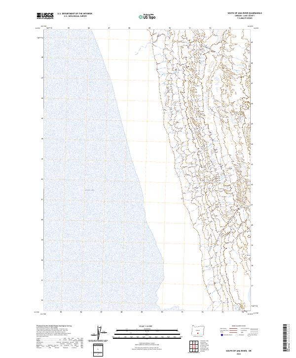
2024 Map of South of Ana River
USGS Topo · Published 2024About this map
Summer Lake dominates the western half of this landscape in Lake County, Oregon, defining a vast alkaline basin where water and sky meet along a shifting eastern shoreline. The terrain is characterized by the stark transition from the lakebed to the rising uplands of the Great Basin, where intricate contour lines reveal the complex drainage patterns of seasonal washes flowing from the eastern ridges. This 2024 survey documents the enduring Public Land Survey System grid, including townships t31s r17e, t31s r18e, t32s r17e, and t32s r18e. The absence of developed roads or settlements on this sheet highlights the wilderness character of the region, emphasizing a landscape primarily shaped by natural hydrology and elevation changes rather than human infrastructure.
Find a feature on this map
5 named features on this map. Tap any name to fly to it.
Don’t see what you’re looking for? This feature index may not catch every label — zoom into the map to look around manually.
Map Details
Editions of this 2024 South of Ana River Map
This is the sole edition of this map. No revisions or reprints were ever made.
Other maps of this area

1955 · Klamath Falls
USGS Topo · 1:250,000

1958 · Klamath Falls
USGS Topo · 1:250,000

1966 · Summer Lake
USGS Topo · 1:24,000

1966 · Slide Mtn
USGS Topo · 1:24,000

1966 · Harvey Creek
USGS Topo · 1:24,000

1966 · Fremont Point
USGS Topo · 1:24,000

1966 · Paisley
USGS Topo · 1:24,000

1974 · Lake Abert
USGS Topo · 1:100,000
1986 · Ana River
USGS Topo · 1:24,000
1986 · Loco Lake
USGS Topo · 1:24,000