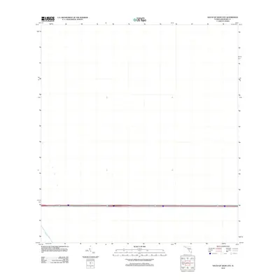
2012 Map of South of Deem City
USGS Topo · Published 2012About this map
Miami Canal defines the lower corridor of this 2012 survey in Broward County, illustrating the massive hydrological engineering that shapes this region south of Deem City. The landscape is characterized by its stark, rectilinear alignment, a hallmark of the modern drainage and water management infrastructure essential to this part of Florida. While the majority of the quadrangle appears as an undeveloped expanse, the prominent alignment of the canal and the primary transportation corridor crossing the lower portion of the sheet demonstrate how human transit and water control intersect in this environment. This map serves as a clear record of the area's geography just after the first decade of the 21st century, showing the precise path of one of the state's most significant arterial waterways.
Find a feature on this map
1 named feature on this map. Tap any name to fly to it.
Don’t see what you’re looking for? This feature index may not catch every label — zoom into the map to look around manually.
Map Details
Editions of this 2012 South of Deem City Map
This is the sole edition of this map. No revisions or reprints were ever made.
Other maps of this area

1956 · West Palm Beach
USGS Topo · 1:250,000

1957 · West Palm Beach
USGS Topo · 1:250,000

1958 · West Palm Beach
USGS Topo · 1:250,000

1963 · Andytown
USGS Topo · 1:24,000

1963 · Cooper City SW
USGS Topo · 1:24,000

1973 · Everglades 4 NW
USGS Topo · 1:24,000

1973 · Everglades 4 NE
USGS Topo · 1:24,000

1973 · Everglades 4 SE
USGS Topo · 1:24,000

1973 · Fort Lauderdale 2 SW
USGS Topo · 1:24,000
1973 · Everglades 4 SW
USGS Topo · 1:24,000