
1973 Map of Fort Lauderdale 2 SW
USGS Topo · Published 1976About this map
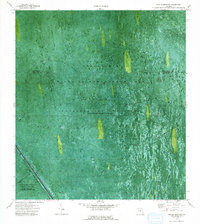
The Everglades dominate this orthophotomap, showing a landscape defined by water management and conservation efforts in the early 1970s. This survey, published by the U.S. Geological Survey, uses aerial photography to capture the intricate network of the North New River Canal and the protective Levee 38 E and Levee 38 W systems. Large sections of the terrain are designated as Wildlife Management Area and Conservation Area No 2A, where water is periodically impounded to regulate the flow across the marshy expanse. Human navigation through this specialized environment is visible through a series of specialized paths, including the Airboat Trail and the curiously named Weasel Trail, which cut through the vegetation. A lone Gaging Sta stands as a testament to the ongoing hydrological monitoring required to maintain this fragile ecosystem at the intersection of Palm Beach and Broward counties.
Find a feature on this map
11 named features on this map. Tap any name to fly to it.
Don’t see what you’re looking for? This feature index may not catch every label — zoom into the map to look around manually.
Map Details
Editions of this 1973 Fort Lauderdale 2 SW Map
2 editions found
Other maps of this area

1956 · West Palm Beach
USGS Topo · 1:250,000

1957 · West Palm Beach
USGS Topo · 1:250,000

1958 · West Palm Beach
USGS Topo · 1:250,000

1963 · Andytown
USGS Topo · 1:24,000

1963 · Fort Lauderdale 2 SE
USGS Topo · 1:24,000
1963 · Cooper City NE
USGS Topo · 1:24,000

1973 · Everglades 4 NE
USGS Topo · 1:24,000
1973 · Fort Lauderdale 2 NE
USGS Topo · 1:24,000

1974 · Everglades 1 SE
USGS Topo · 1:24,000
1974 · Fort Lauderdale 2 NW
USGS Topo · 1:24,000