
1974 Map of Everglades 1 SE
USGS Topo · Published 1976About this map
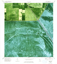
Agricultural reclamation and massive water management projects define this landscape on the border of Broward and Palm Beach counties during the early 1970s. The northern portion of the map shows an organized grid of fields and pumps, while the southern expanse is dominated by the Everglades Wildlife Management Area. Human presence is concentrated at the junction of major waterways, where the small settlements of Deem City and Terrytown sit adjacent to the North New River Canal. This infrastructure is vital to the region, featuring Pumping Sta No 7 and a series of barriers including Levee 5 and Levee 38W. The map provides a specialized look at Everglades navigation, marking specific paths through the sawgrass such as the Weasel Airboat Trail and several other Airboat Trail routes, essential for traversing the Conservation Area No 3 A.
Find a feature on this map
19 named features on this map. Tap any name to fly to it.
Don’t see what you’re looking for? This feature index may not catch every label — zoom into the map to look around manually.
Map Details
Editions of this 1974 Everglades 1 SE Map
2 editions found
Other maps of this area

1956 · West Palm Beach
USGS Topo · 1:250,000

1957 · West Palm Beach
USGS Topo · 1:250,000

1958 · West Palm Beach
USGS Topo · 1:250,000

1963 · Andytown
USGS Topo · 1:24,000

1973 · Everglades 4 NW
USGS Topo · 1:24,000

1973 · Everglades 4 NE
USGS Topo · 1:24,000

1973 · Fort Lauderdale 2 SW
USGS Topo · 1:24,000

1974 · Everglades 1 SW
USGS Topo · 1:24,000

1974 · Everglades 1 NW
USGS Topo · 1:24,000
1974 · Fort Lauderdale 2 NW
USGS Topo · 1:24,000