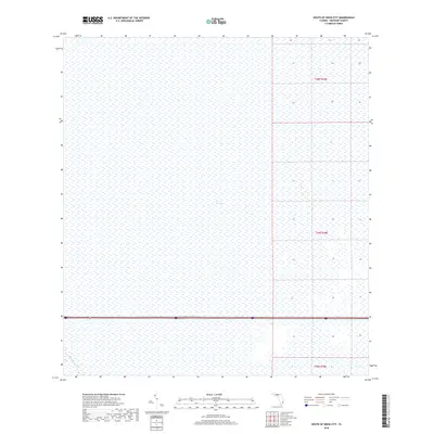
2018 Map of South of Deem City
USGS Topo · Published 2018About this map
The Everglades dominates this landscape, showing the vast reach of the Florida wetlands in the late 2010s. The sheet is defined by its intricate network of marshland, which remains largely untouched by urban development. Modern infrastructure is represented primarily by the Miami Canal, which cuts through the southwestern corner, and the east-west corridor of Interstate 75 and State Road 84 that bisects the lower third of the quadrangle. This layout highlights the contrast between the preserved natural environment and the vital transportation arteries that cross it. The map also detail the Public Land Survey System divisions, including T48s R38e, T49s R38e, and T50s R38e, providing a clear look at the township and range boundaries that govern this part of Broward County.
Find a feature on this map
7 named features on this map. Tap any name to fly to it.
Don’t see what you’re looking for? This feature index may not catch every label — zoom into the map to look around manually.
Map Details
Editions of this 2018 South of Deem City Map
This is the sole edition of this map. No revisions or reprints were ever made.
Other maps of this area

1956 · West Palm Beach
USGS Topo · 1:250,000

1957 · West Palm Beach
USGS Topo · 1:250,000

1958 · West Palm Beach
USGS Topo · 1:250,000

1963 · Andytown
USGS Topo · 1:24,000

1963 · Cooper City SW
USGS Topo · 1:24,000

1973 · Everglades 4 NW
USGS Topo · 1:24,000

1973 · Everglades 4 NE
USGS Topo · 1:24,000

1973 · Everglades 4 SE
USGS Topo · 1:24,000

1973 · Fort Lauderdale 2 SW
USGS Topo · 1:24,000
1973 · Everglades 4 SW
USGS Topo · 1:24,000