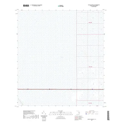
2021 Map of South of Deem City
USGS Topo · Published 2021About this map
The Everglades dominates this portion of Broward County, presented here as a vast expanse of sawgrass and wetlands managed by the U.S. Geological Survey. The landscape is defined by its lack of vertical relief and the deliberate engineering of the South Florida water management system. The Miami Canal cuts across the southwestern corner of the quadrangle, serving as a primary artery for drainage and water transport through the marshes. Modern transportation infrastructure bisects the wetland, with Interstate 75 and State Road 84 running parallel through the southern section of the sheet. These corridors represent the primary human imprint on an otherwise protected environment, where township and range lines like t49s r38e provide the only formal structure across the open terrain.
Find a feature on this map
7 named features on this map. Tap any name to fly to it.
Don’t see what you’re looking for? This feature index may not catch every label — zoom into the map to look around manually.
Map Details
Editions of this 2021 South of Deem City Map
This is the sole edition of this map. No revisions or reprints were ever made.
Other maps of this area

1956 · West Palm Beach
USGS Topo · 1:250,000

1957 · West Palm Beach
USGS Topo · 1:250,000

1958 · West Palm Beach
USGS Topo · 1:250,000

1963 · Andytown
USGS Topo · 1:24,000

1963 · Cooper City SW
USGS Topo · 1:24,000

1973 · Everglades 4 NW
USGS Topo · 1:24,000

1973 · Everglades 4 NE
USGS Topo · 1:24,000

1973 · Everglades 4 SE
USGS Topo · 1:24,000

1973 · Fort Lauderdale 2 SW
USGS Topo · 1:24,000
1973 · Everglades 4 SW
USGS Topo · 1:24,000