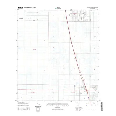
2015 Map of South of Fellsmere
USGS Topo · Published 2015About this map
Fellsmere and its southern agricultural hinterlands are captured during a period of transition in the mid-2010s. The landscape is defined by a rigid grid of irrigation and drainage infrastructure, most notably the Darby Can and the various canals flanking the township lines. The northern section of the map shows the residential expansion of the city, with streets like 83rd St and 81st St extending into former citrus or wetland areas. Further south, the New Hibiscus Airpark stands as a focal point for aviation in this rural corridor, located just north of the major thoroughfare Sr 60. The survey meticulously details the Public Land Survey System divisions, including t30s r36e and t31s r38e, illustrating how historical land grants continue to dictate modern property boundaries and road placements like 130th Ave in Indian River County.
Find a feature on this map
99 named features on this map. Tap any name to fly to it.
Don’t see what you’re looking for? This feature index may not catch every label — zoom into the map to look around manually.
Map Details
Editions of this 2015 South of Fellsmere Map
This is the sole edition of this map. No revisions or reprints were ever made.
Other maps of this area

1949 · Fellsmere
USGS Topo · 1:24,000

1949 · Vero Beach
USGS Topo · 1:24,000

1949 · Sebastian
USGS Topo · 1:24,000

1949 · Oslo
USGS Topo · 1:24,000

1950 · Oslo
USGS Topo · 1:24,000

1950 · Vero Beach
USGS Topo · 1:24,000

1951 · Fellsmere
USGS Topo · 1:24,000

1951 · Sebastian
USGS Topo · 1:24,000

1953 · Fellsmere SW
USGS Topo · 1:24,000

1953 · Fellsmere 4 SE
USGS Topo · 1:24,000