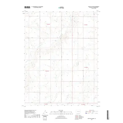
2019 Map of South of Flagler
USGS Topo · Published 2019About this map
The S Fork Republican River defines the northern landscape of this High Plains territory, carving a distinct drainage path through the eastern Colorado prairie. In this late 2010s survey, the area south of Flagler remains defined by its rigorous township and range grid, with Sand Cr and Spring Cr providing secondary drainage through the rolling tablelands. The infrastructure is characterized by an extensive network of county roads, including Co Rd R and Co Rd G, which navigate the rectangular sections of Kit Carson County. These corridors, such as Co Rd 5 1/10, follow the precise survey lines established decades earlier, reflecting the enduring agricultural and ranching patterns of the region. The map captures the quiet intersection of natural watercourses and the human-imposed geometry of the American West.
Find a feature on this map
20 named features on this map. Tap any name to fly to it.
Don’t see what you’re looking for? This feature index may not catch every label — zoom into the map to look around manually.
Map Details
Editions of this 2019 South of Flagler Map
This is the sole edition of this map. No revisions or reprints were ever made.
Other maps of this area

1954 · Limon
USGS Topo · 1:250,000

1957 · Limon
USGS Topo · 1:250,000

1958 · Limon
USGS Topo · 1:250,000

1978 · Hugo 4 NW
USGS Topo · 1:24,000

1979 · Hugo 4 NE
USGS Topo · 1:24,000

1979 · Flagler SW
USGS Topo · 1:24,000

1979 · Flagler
USGS Topo · 1:24,000
1979 · Hugo 4 SE
USGS Topo · 1:24,000
1979 · Hugo 4 NW
USGS Topo · 1:24,000
1979 · Stratton 3 SW
USGS Topo · 1:24,000