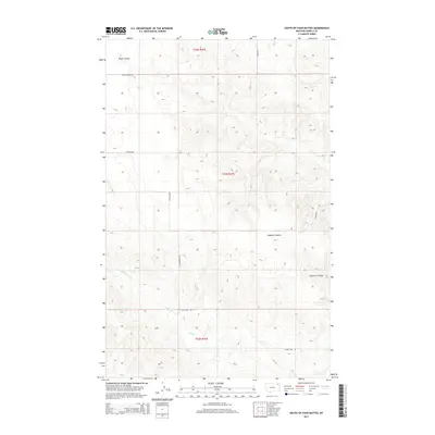
2014 Map of South of Four Buttes
USGS Topo · Published 2014About this map
Police Creek winds through the southern reaches of this landscape in the Wolf Point District, reflecting the drainage patterns characteristic of the high plains in Roosevelt County. The topography is defined by significant coulees, most notably the winding paths of Cabarett Coulee and Negro Coulee. Unlike many maps of the western plains that emphasize town centers, this survey highlights the rural infrastructure and land management divisions of t35n r47e, t34n r47e, and t33n r47e. Local travel is facilitated by a network of gravel roads and section lines including Silver Star Rd and Police Creek Rd, which provide access to the expansive agricultural and grazing lands. The layout of Ferestad Rd and Linderman Rd suggests the enduring importance of the Public Land Survey System in organizing this Montana terrain.
Find a feature on this map
12 named features on this map. Tap any name to fly to it.
Don’t see what you’re looking for? This feature index may not catch every label — zoom into the map to look around manually.
Map Details
Editions of this 2014 South of Four Buttes Map
This is the sole edition of this map. No revisions or reprints were ever made.
Other maps of this area

1954 · Wolf Point
USGS Topo · 1:250,000

1958 · Wolf Point
USGS Topo · 1:250,000

1973 · Peerless 4 NE
USGS Topo · 1:24,000

1973 · Scobey
USGS Topo · 1:24,000

1973 · Nielsen Coulee
USGS Topo · 1:24,000

1973 · Killenbeck Reservoir
USGS Topo · 1:24,000

1973 · Cabarett Coulee
USGS Topo · 1:24,000

1973 · Peerless 4 SE
USGS Topo · 1:24,000

1973 · Peerless 4 SW
USGS Topo · 1:24,000

1973 · Four Buttes
USGS Topo · 1:24,000