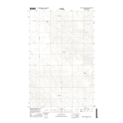
2017 Map of South of Four Buttes
USGS Topo · Published 2017About this map
Negro Coulee and Police Cr define the drainage patterns of this high plains landscape south of Four Buttes during the early 21st century. The map reveals a highly structured Public Land Survey System grid, where section lines dictated the placement of local thoroughfares such as S Four Buttes Rd and Silver Star Rd. The terrain is marked by intermittent watercourses like Cabarett Coulee, which cut through the undulating elevations of Daniels and Roosevelt counties. This documentation provides a clear view of the rural infrastructure in the Wolf Point District, showing how modern access roads like Linderman Rd, Wilcoxon Rd, and Ferestad Rd serve the remote agricultural and ranching parcels of the Montana frontier.
Find a feature on this map
12 named features on this map. Tap any name to fly to it.
Don’t see what you’re looking for? This feature index may not catch every label — zoom into the map to look around manually.
Map Details
Editions of this 2017 South of Four Buttes Map
This is the sole edition of this map. No revisions or reprints were ever made.
Other maps of this area

1954 · Wolf Point
USGS Topo · 1:250,000

1958 · Wolf Point
USGS Topo · 1:250,000

1973 · Peerless 4 NE
USGS Topo · 1:24,000

1973 · Scobey
USGS Topo · 1:24,000

1973 · Nielsen Coulee
USGS Topo · 1:24,000

1973 · Killenbeck Reservoir
USGS Topo · 1:24,000

1973 · Cabarett Coulee
USGS Topo · 1:24,000

1973 · Peerless 4 SE
USGS Topo · 1:24,000

1973 · Peerless 4 SW
USGS Topo · 1:24,000

1973 · Four Buttes
USGS Topo · 1:24,000