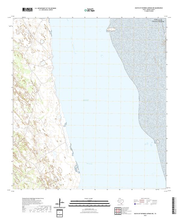
2022 Map of South of Potrero Lopeno NW
USGS Topo · Published 2022About this map
Padre Island National Seashore spans the eastern edge of this coastal survey, where the shifting sands meet the Gulf waters in a landscape dominated by tidal action and sparse vegetation. The central focus is the wide expanse of the Laguna Madre, bisected by the Intracoastal Waterway, a critical maritime artery that facilitates commerce and navigation through the shallow coastal bays. To the south, the waters open into Red Fish Bay, illustrating the complex estuarine environment characteristic of this part of Kenedy County. The mainland shoreline is defined by intricate contouring and small marshes, reflecting the subtle elevation changes of the Texas coastal bend. This study provides a contemporary view of the maritime boundaries and hydrographic features that define this uninhabited stretch of the Texas coast, where the relationship between the barrier island and the inland bay remains the primary geographical feature.
Find a feature on this map
3 named features on this map. Tap any name to fly to it.
Don’t see what you’re looking for? This feature index may not catch every label — zoom into the map to look around manually.
Map Details
Editions of this 2022 South of Potrero Lopeno NW Map
This is the sole edition of this map. No revisions or reprints were ever made.
Other maps of this area

1921 · Tarida Ranch
USGS Topo · 1:62,500

1923 · Lopena Island
USGS Topo · 1:62,500

1923 · Saltillo Ranch
USGS Topo · 1:62,500

1951 · South of Potrero Lopeno NE
USGS Topo · 1:24,000

1952 · Potrero Lopeno SE
USGS Topo · 1:24,000

1952 · South of Potrero Lopeno NW
USGS Topo · 1:24,000

1952 · South of Potrero Lopeno SE
USGS Topo · 1:24,000

1952 · Port Mansfield
USGS Topo · 1:24,000

1952 · Potrero Lopeno SW
USGS Topo · 1:24,000

1952 · Potrero Lopeno
USGS Topo · 1:62,500