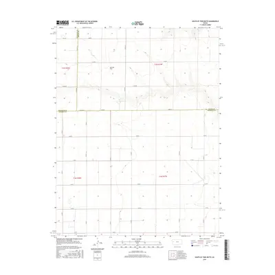
2016 Map of South of Twin Butte
USGS Topo · Published 2016About this map
Harrison Flats dominates this portion of the High Plains, where the intersection of Wallace, Logan, and Wichita counties defines the local geography. The landscape is characterized by a strict section-line road grid that supports the agricultural operations of Harrison Township. A network of rural routes with descriptive names such as Dusty Rd, Bumpy Rd, and Bison Rd provides access to the expansive plateaus and drainage breaks. The prominence of Co Rd Adobe and Adobe Rd suggests the historical importance of these east-west thoroughfares across the western Kansas terrain during the early 21st century. This map serves as a precise record of land divisions and the sparse but vital infrastructure of the remote prairie.
Find a feature on this map
18 named features on this map. Tap any name to fly to it.
Don’t see what you’re looking for? This feature index may not catch every label — zoom into the map to look around manually.
Map Details
Editions of this 2016 South of Twin Butte Map
This is the sole edition of this map. No revisions or reprints were ever made.
Other maps of this area

1955 · Scott City
USGS Topo · 1:250,000

1958 · Scott City
USGS Topo · 1:250,000

1959 · Wallace
USGS Topo · 1:62,500

1968 · Russell Springs 3 SW
USGS Topo · 1:24,000

1968 · Russell Springs 3 NW
USGS Topo · 1:24,000

1968 · Russell Springs 3 SE
USGS Topo · 1:24,000

1968 · Sharon Springs 4 NE
USGS Topo · 1:24,000

1968 · Russell Springs 3 NE
USGS Topo · 1:24,000

1969 · Russell Springs 2 SW
USGS Topo · 1:24,000

1969 · Russell Springs 2 SE
USGS Topo · 1:24,000